Menu
Overall ranking:

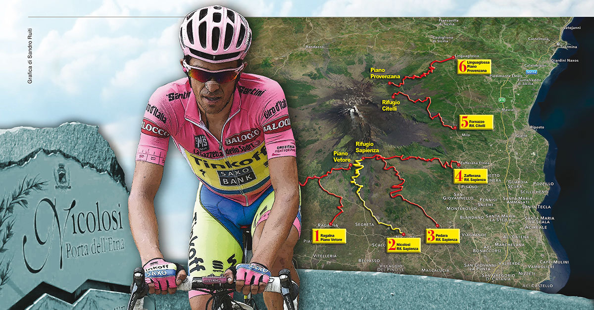
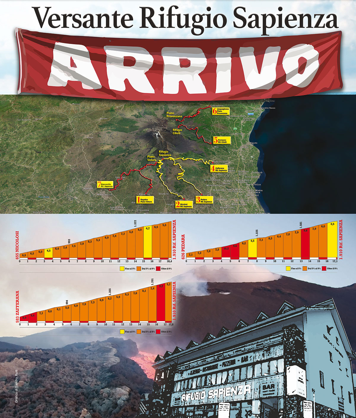
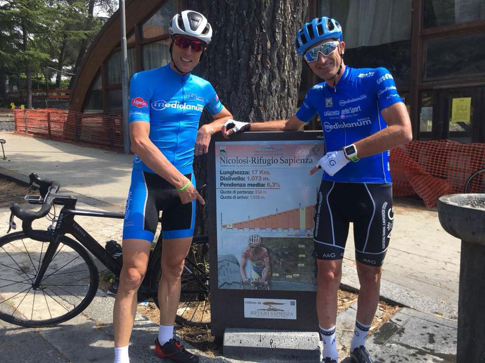
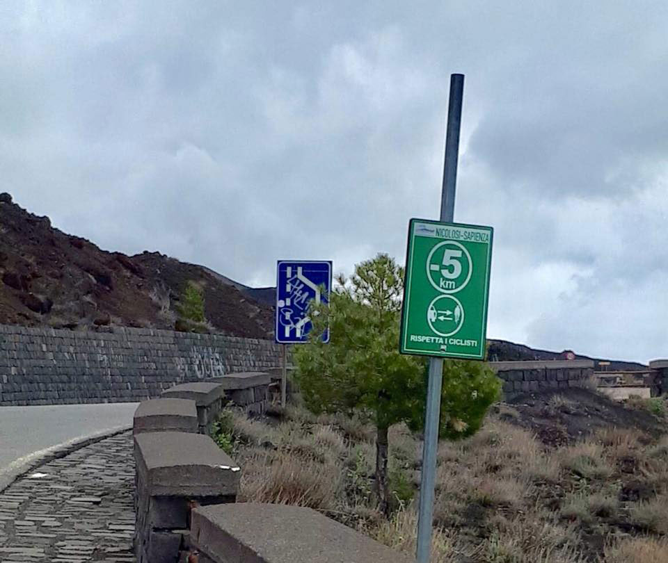
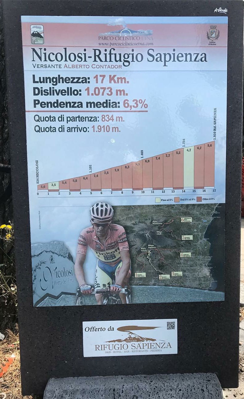
Seventeen kilometers at 6% average, with its 1074 meters in altitude is the most known side, the most transited one, that of the stage of the Giro d’Italia won by Alberto Contador in May 2011.
Panoramic road, smooth and well-tended asphalt, recently rebuilt above the lava flow of July-August 2001, just because "young" is kept in very good condition and scenographically very captivating. Little walls of lava-stones contain it all the way and during the entire climb, from the first to the last kilometer, pedaling you have the opportunity to see your landing: the Rifugio Sapienza leaning there on the two thirds of the mountain, on the south side swept from the lava and therefore without a thread of vegetation.
Go up, climb and furrow a sea of magma, with the scent of sulfur that accompanies you pedaling after pedaling: it is the side of the catanian people, the one that connects the city more directly with the Mountain, the one that looks down at the sea on the port of Catania.
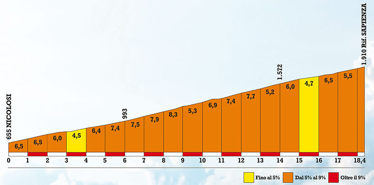
The climb begins hard leaving the town of Nicolosi, as soon as you pass the roundabout of the Palaghiaccio (by the way: right at the roundabout is a fountain of drinking water that gushes clear all year round, good to fill the water bottle) up to 7 average per cent for about two kilometers. Arrived at the Pineta dei Monti Rossi, which anticipates Nicolosi's quarry, the road extends for about three hundred meters and then starts to climb for about two kilometers with slopes between 4 and 5 percent.
It is here, we are at an altitude of 970 meters, that at the beginning of a long straight you begin to see in all its majesty the lava flow, more than ten kilometers long, starting at 2100, just behind the Rifugio Sapienza, in serious danger the village of Nicolosi. Here: the Nicolosi-Sapienza side is just the one that flows.
At an altitude of 1,000 change the slope again, because the rounds that lead in little less than two kilometers to the restaurant Nuova Quercia exceed for some tracts the 10 percent of slope, and then finally pave right in front of the restaurant. If you are thirsty or hungry take advantage of it: because from then on there are still 10 kilometers of climb, almost an hour under the sun for a mid-level cyclist and remain prey to a crisis of hunger or dehydration at that point then forces you to go back.
At this point, we are at an altitude of 1300 meters, the road begins a series of wide bends and panoramic curves that always maintain a constant slope of 6 percent and just at the fifth bend after the restaurant Nuova Quercia, when above 1,450 meters the air it becomes finer and oxygen begins to run out Alberto Contador launched his deadly attack, which took him after 7.5 kilometers of overwhelming action to the triumph on the Piazzale Rifugio Sapienza. The last 3 kilometers are often lashed by wind, which, given the location of the hairpin bends, can sometimes be in favor and sometimes against, but never so violent as to prevent you from climbing. In fact, Mount Etna is a mountain that attracts winds, but at the same time it also dampens them.

Parco dell'Etna
Comune di Ragalna
Comune di Nicolosi
Comune di Pedara
Comune di Zafferana
Comune di Milo
Comune di Linguaglossa
Comune di Sant'Alfio
Comune di Biancavilla

© Parco Ciclistico Etna
Developed by pragmas.org